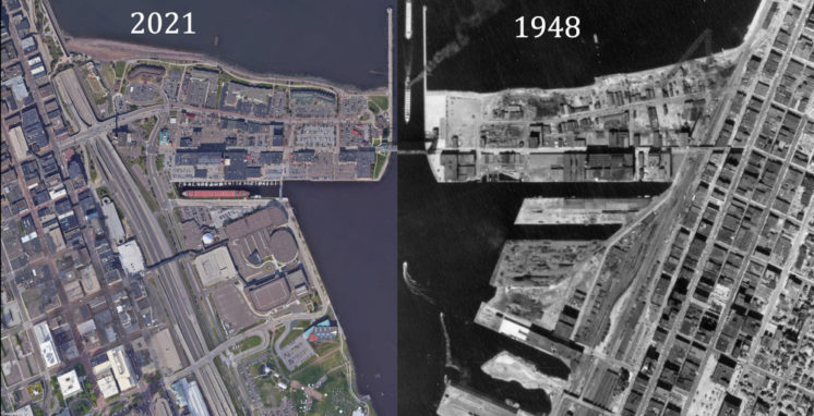
Duluth aerial photos, then and now, compared and combined
Sometime back, I included an aerial photo in a PDD comment and realized that because they are taken from straight overhead, the photos on Minnesota Historical Aerial Photographs Online can be matched up pretty easily with Google’s current aerial imagery. And then I put that thought aside for quite some months until I finally came back to it and put together this seven-part series of aerial photos showing places in Duluth that have changed somewhat dramatically over the past decades.


