100 Years of Intercity Highway, or Highway 61 Revisited
A monument a couple blocks north of I-35 in the front yard of a quiet residential neighborhood commemorates the upcoming opening of Minnesota Trunk Highway No. 1. It was erected on June 13, 1924, 100 years ago today. A recent post on this site featured a photo describing a campground along this Highway, which led to a brief discussion of just what this Highway 1 was and what became of it.

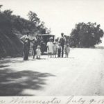
1932 postcard showing a campsite along Highway 1.
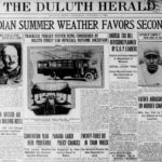
According to an article by Chuck Frederick based on research done by David Ouse, on July 16, 1924, a ceremony was held at the monument to announce the official opening of the first paved section on the northern end of a new road connecting Duluth with the Twin Cities. The section went from 59th Avenue West to Esko’s Corner in Carlton County, with a paved link to Cloquet expected to be completed by the end of the year.

A 1948 map showing the route of the highway from Cloquet into Duluth. (Photo from the Northeast Minnesota Historical Collections)
I recently finished an oral history with my great-aunt who grew up in Cloquet. She turned one hundred herself two months ago. When we talked about her childhood, she often told stories about her weekend trips up to Duluth to visit her cousin and shop downtown at Oreck’s Department Store. My dad wondered how her family could have made the trip from Cloquet to Duluth so frequently given that the road between the cities must have been quite rough in those days. My great-aunt didn’t remember it that way. This 100-year-old monument explains why. The road was brand new.

Superior Street at First Avenue West in 1925, with Oreck’s Department Store on the left. (Photo by Hugh McKenzie from the Northeast Minnesota Historical Collections)
My great-aunt moved to San Diego in the late 1940s and her cousin no longer lives on Chester Park Drive but both of their childhood homes are still standing. Oreck’s is long gone but the buildings it occupied are still a part of Superior Street. And Highway 1 won’t take you to Cloquet anymore but you can still find traces of it on the edge of Duluth. Some years after opening, it was designated as a part of Highway 61. In the 1960s, it lost much of its right of way to the construction of I-35. But as noted in the Duluth News Tribune article, parts of it still exist. Not just the residential street that the monument now adorns, but also an overgrown stretch of asphalt blocked off to car traffic between Kingsbury Creek and West Gate Boulevard at 68th Avenue West.

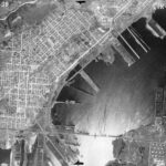
Top: A 1939 aerial image from MHAPO showing Highway 1/61 in red. Bottom: A 2024 Google Satellite image showing the remnants of Highway 1 above I-35.
So if you want to celebrate 100 years of intercity automobility in the region, the best way might be to get out of your car and go for a walk down the center of the old highway.

A Google Photosphere showing the transformation of Duluth’s first intercity highway into a hiking trail.
Recommended Links:
Leave a Comment
Only registered members can post a comment , Login / Register Here


1 Comment
Kodiak
about 6 months ago