PDD Geoguessr #33: Walking Shortcuts
Over the past 100 years, the increase in car use has changed the Duluth landscape. Downtown has fewer shoppers walking the streets and traffic is heavy on the roads to the big box stores at the top of the hill. Whole neighborhoods have been torn down to make room for highways. But the particular geography of Duluth has resulted in a number of urban routes open only to people walking (and, for some, also biking). This post takes a closer look at a few of those locations and concludes with a Geoguessr game testing your knowledge of travel routes in Duluth closed to cars.
Two main obstacles are primarily responsible for creating the many places in Duluth where car traffic comes to a stop: streams and hills. Sometimes even these obstacles have been overcome. One of my favorite Perfect Duluth Day mystery photos shows a wooden walkway on the Central Hillside before the rock was blasted through in order to connect Central Entrance with Sixth Avenue East.
Streams have been altered to make the city more car accessible as well. Some Duluth Creeks have been moved underground, but many are still crisscrossed by pedestrian bridges that connect adjacent neighborhoods. And of course, bridges for cars have been added as well. The 1909 Sanborn map shows what East Ninth Street looked like before the construction of the bridge over Chester Creek. The creek is labelled simply as “deep ravine” with the road ending with the word “impassable.” It is now quite passable.

The 1909 Sanborn Map shows Ninth Street ending at Chester Creek. (Image from the Library of Congress)
But even with the bridge across Chester Creek, pedestrians still have a decided advantage. What makes Chester Creek my favorite in the city is that it doesn’t just provide a route for recreational hiking. With the northern end of the trails adjacent to the University of Minnesota Duluth campus and the southern end just a few blocks away from downtown, it serves as a grade separated commuting corridor between the hillside neighborhoods and the campus.
And while Duluth has opened up different routes for driving over time, it has closed some off as well. When the Congdon Park neighborhood was being further developed in the late 1960s and 1970s, one street, Aspen Lane, was built to connect the new development with the adjacent Hunter’s Park Neighborhood. At some point after being constructed, most likely to limit through traffic, a grove of small trees was added, permanently blocking those driving but not those walking.

Top: Aspen Lane in 1971 and 2022, with the pedestrian connection circled in orange. Bottom: The West and East sides of Aspen Lane. Right: The blue line shows the division between Hunter’s Park and Congdon Park with the pedestrian connection marked with an orange circle. (Photos from MHAPO and Google)
I found out about this shortcut from a friend who lived in Congdon Park. One day I went with him by bike to the Mount Royal Shopping Center. It took about five minutes crossing through that grove of trees and that short trip forced me to readjust my entire mental map of Duluth. I thought of Mount Royal as being on the northern side of Duluth and Congdon Park as being on the eastern side of Duluth. I had to rethink everything as being on the northeast side of the city. As a illustration of this shortcut’s value, if you live on the East side of Aspen Lane and attend Glen Avon Presbyterian Church, the trip is either a half-mile walk or a two-mile drive. It’s a good shortcut. But there are many others throughout the city. This Geoguessr challenge looks at five of them. Each round has a time limit of three minutes.
PDD Geoguessr #33: Walking Shortcuts
How to Play Geoguessr
GeoGuessr can be played on a laptop or desktop and on Android or IoS mobile devices with the GeoGuessr app. Just click on the link that fits how you play. You can create an account to keep track of your scores and see how you compare to other players or just click on the link above to play as a guest without having to create an account or log in.
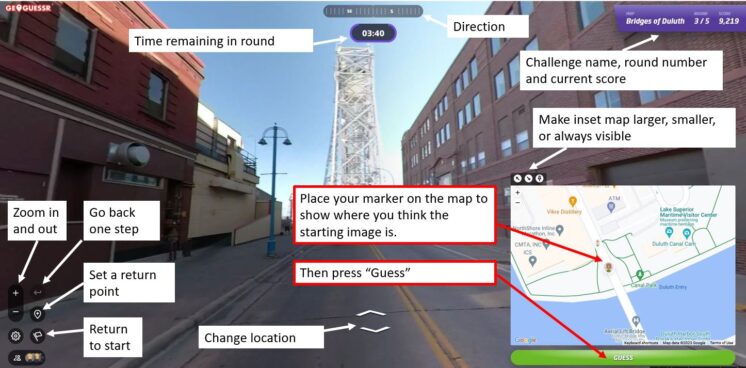
Every game consists of five locations based on a theme chosen by the game creator. You are shown a Streetview image stripped of all the informational labels that are normally overlayed onto the image. Unless the challenge specifically restricts it, you can move around and look for clues like street signs and business names to find out where you are. The image below shows a basic overview of the Geoguessr screen layout and controls.
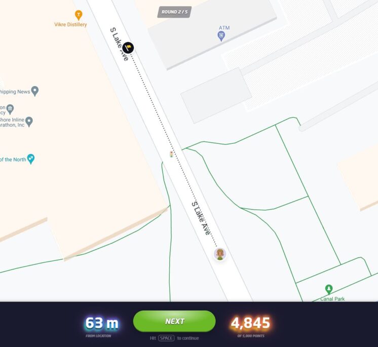
Once you think you know the location — or are nearly out of time — you use the inset map to place your marker where you believe the round started. After you hit “Guess,” you will see how close you were to the correct location and how many points your guess earned. The closer you are to the location, the higher your score, with a maximum score of 5,000 points. On a map that covers a small area, like the Gary-New Duluth neighborhood, being off by a few blocks will cost you a lot of points. On a map that has locations from around the world, you will get nearly all the points just for finding the right city. The maximum error for a perfect score also changes by map size, but in general if you are within 50 feet (15 meters) you will always get the full 5,000 points.
Not often, but every now and then, GeoGuessr gets a little buggy. If the underlying Streetview imagery has changed since the game was made, sometimes it repeats the last round, gives a black screen, or doesn’t allow a guess to be made. If that happens, please let me know and I’ll update the challenge.
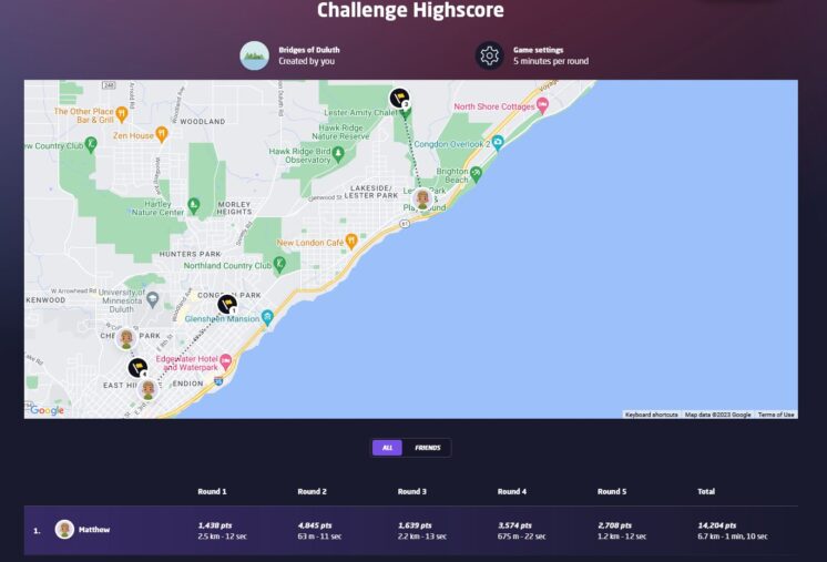
At the end of the five rounds, an overview screen shows your score for each round in addition to your guessing time and how far off you were from the correct location. The correct locations and your guesses are also shown on a map and you can click on any of the round numbers to review the locations. Additionally, the final screen in a challenge will show how you rank compared to the top scorers of the challenge. When choosing your user name, keep in mind that your user name and score per round will be visible to other players of the challenge.
If you have feedback on this challenge or ideas for future challenges, please share them in the comments below.
Recommended Links:
Leave a Comment
Only registered members can post a comment , Login / Register Here


No Comments