PDD Geoguessr #25: Duluth Creeks

The lower falls of Chester Creek. (Photo by Matthew James)
Forty-two named streams run through the Duluth metropolitan area, from Mission Creek in West Duluth to the Lester River on the eastern edge of the city. This Geoguessr challenge looks at photospheres from five of the creeks within the Duluth Urban Watershed.

An interactive map of all 42 Duluth streams can be found on the Lake Superior Streams website.
The best known of Duluth’s creeks are the ones with trail systems running along their banks. Miller Creek, Chester Creek and Amity Creek are likely quite familiar to anyone has looked for a good place to go on a fall hike. But there are so many more with much lesser visibility, sometimes literally. Many of Duluth’s creeks are largely underground for significant portions of their downhill journeys, like Brewery Creek, Clarkhouse Creek, or Oregon Creek. Of course this wasn’t always the case. According to old Duluth fire insurance maps, a wooden bridge used to be necessary to cross Sixth Avenue East.

A section of the central hillside from a 1909 Sanborn map
I had one of these lesser known creeks in my neighborhood growing up. A section of Grey’s Creek used to make a brief appearance on the block across the street from me. It flowed out of a stone wall on the south side of East Sixth Street, creating a small waterfall that emptied into a pool of modest depth and then flowed through a vacant lot filled with overgrown plants before disappearing under the alley through another tunnel. We never called it Grey’s Creek or anything at all really other than “the creek,” a term generally appearing in sentences uttered by the parents of my downstairs neighbors when going out to play, such as “Be back by six and don’t go to the creek.”
During the winter of sixth grade, I walked home from school every day with my friend Mickinok. He had recently read a story about Captain Shackleton and his desperate struggle to free the Endurance from the Antarctic ice. This story thoroughly captured his imagination. As soon as we left the school building, he declared himself Trailblazer Mickey and I was his pack mule, Betsy, tasked with carrying his backpack (we once switched roles, and after both agreed the original arrangement worked just fine).
On our walk down the hill, we would stop at this short section of Grey’s Creek below Sixth Street and place a glass Coke bottle at the center of the frozen pool below the waterfall. This was the Endurance and it had to be freed from the ice. We would stomp in front of the bottle until the ice gave way, clearing a path to the tunnel and then lifting the bottle out so we would have it for the next day. We would often stomp too hard, breaking through the ice and plunging a leg into the water underneath, making it necessary to walk home with one soaking wet foot. We never fell in completely, but it certainly wasn’t for a lack of effort.
In 2002, the city moved this section of Grey’s Creek underground. We never told anyone what we did, so that decision wasn’t a direct consequence of our actions. But I imagined city officials, and my downstairs neighbor’s parents, had something of the sort in mind when they decided it would be best to limit access to this section of the creek.

Grey’s Creek now runs below this vacant lot (Photo by Matthew James)
So the section of creek that I know best in Duluth is now one that isn’t known at all. I only came to know it so well because it was so close to my house. And I imagine that’s true for most people’s relationship to the 42 streams that run through Duluth. Regardless of their prominence in the city, the ones nearby are the ones people know best. For that reason, this Geoguessr challenge may be more of a challenge than most. All the creeks featured are ones with trail systems and with clear landmarks visible, but the locations span the full width of the city. I think everyone who plays will find a round or two to be a bit too easy, but which rounds those are will likely be different for everyone.
Because the game consists entirely of Photospheres, the time limit per round for this challenge is 3 minutes.
PDD Geoguessr Challenge #25: Duluth Creek Photospheres
How to Play Geoguessr
GeoGuessr can be played on a laptop or desktop and on Android or IoS mobile devices with the GeoGuessr app. Just click on the link that fits how you play. You can create an account to keep track of your scores and see how you compare to other players or just click on the link above to play as a guest without having to create an account or log in.
Every game consists of five locations based on a theme chosen by the game creator. You are shown a Streetview image stripped of all the informational labels that are normally overlayed onto the image. Unless the challenge specifically restricts it, you can move around and look for clues like street signs and business names to find out where you are. The image below shows a basic overview of the Geoguessr screen layout and controls.
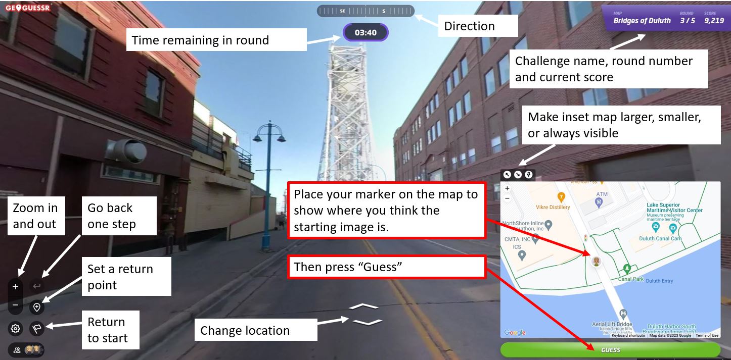
Once you think you know the location — or are nearly out of time — you use the inset map to place your marker where you believe the round started. After you hit “Guess,” you will see how close you were to the correct location and how many points your guess earned. The closer you are to the location, the higher your score, with a maximum score of 5,000 points. On a map that covers a small area, like the Gary-New Duluth neighborhood, being off by a few blocks will cost you a lot of points. On a map that has locations from around the world, you will get nearly all the points just for finding the right city. The maximum error for a perfect score also changes by map size, but in general if you are within 50 feet (15 meters) you will always get the full 5,000 points.
Not often, but every now and then, GeoGuessr gets a little buggy. If the underlying Streetview imagery has changed since the game was made, sometimes it repeats the last round, gives a black screen, or doesn’t allow a guess to be made. If that happens, please let me know and I’ll update the challenge.
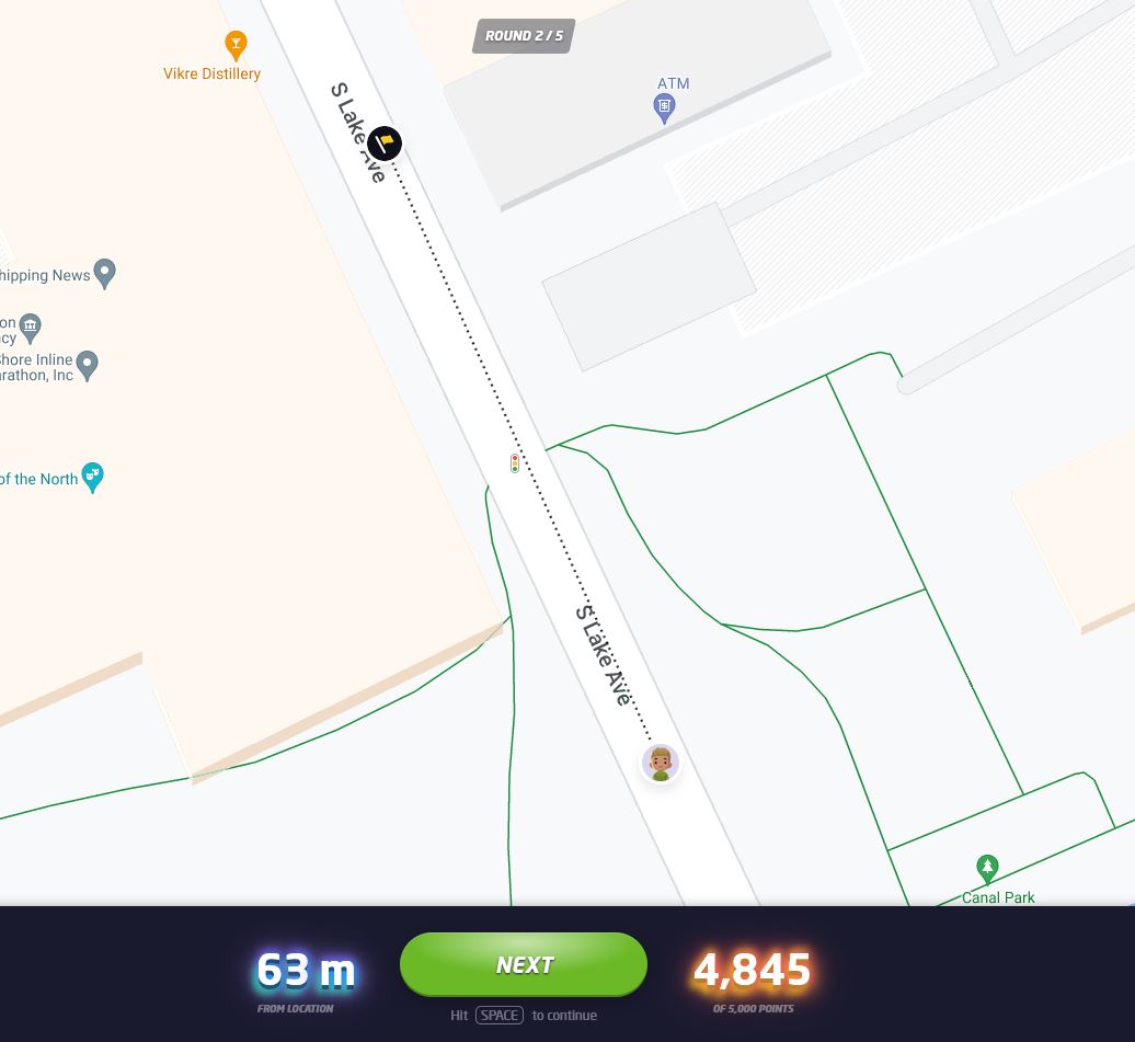
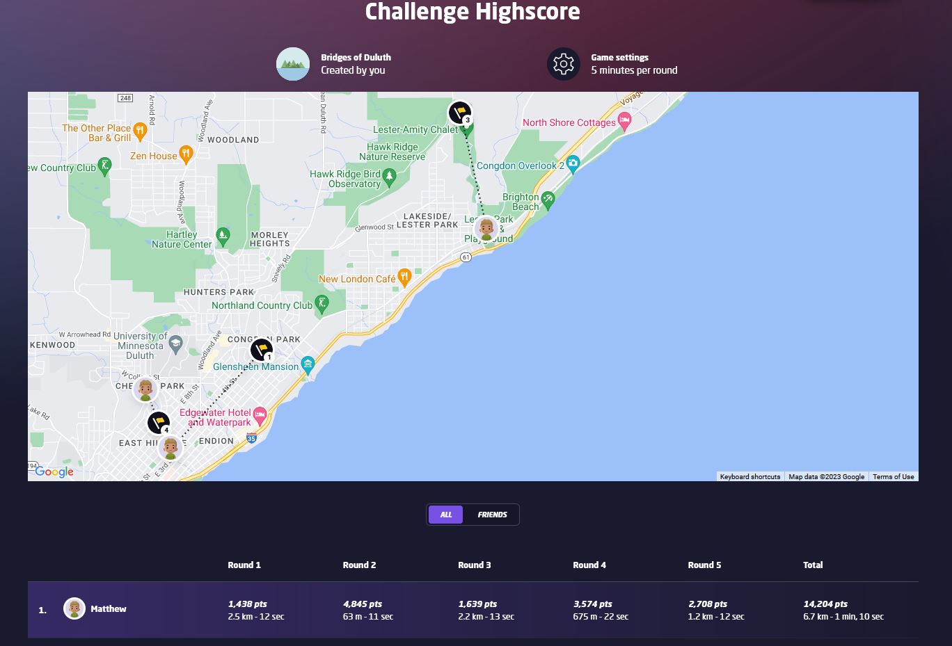
At the end of the five rounds, an overview screen shows your score for each round in addition to your guessing time and how far off you were from the correct location. The correct locations and your guesses are also shown on a map and you can click on any of the round numbers to review the locations. Additionally, the final screen in a challenge will show how you rank compared to the top scorers of the challenge. When choosing your user name, keep in mind that your user name and score per round will be visible to other players of the challenge.
If you have feedback on this challenge or ideas for future challenges, please share them in the comments below.


Leave a Comment
Only registered members can post a comment , Login / Register Here


No Comments